The downstream settlement
North Lansing began as the lower of three early villages along the Grand River. “Lower” referred to its downstream position, not to importance. The settlement formed around practical advantages: a dam built by John W. Burchard in 1843, a sawmill erected the following year and a road crossing that connected the river site to travel across the region.
When Lansing Township was chosen as Michigan’s capital site in 1847, the lower village did not disappear into the planned civic center. A bridge strengthened the crossing, and stores and lodging developed along the road. The village acquired a commercial identity of its own while remaining connected to the middle village around the capitol grounds.
From wood settlement to brick street wall
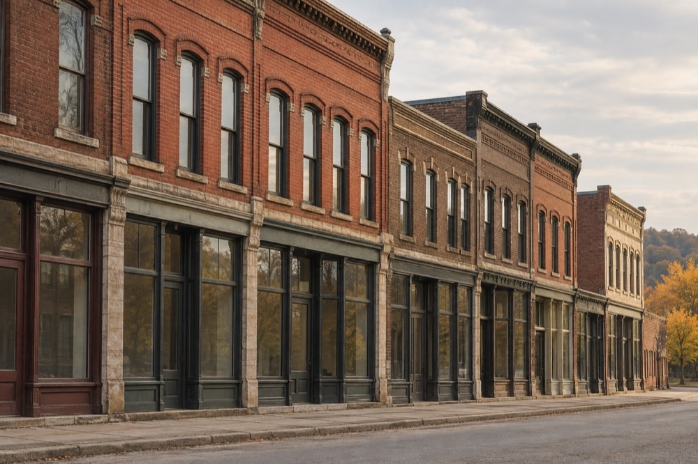
Much of the commercial center was rebuilt between 1875 and 1920. That span carried North Lansing from the aftermath of early settlement through the growth of rail and industry. Brick business blocks replaced or supplemented earlier, more temporary structures. Shared walls, repeated upper windows and defined cornices produced a continuous urban street edge.
The surviving concentration became known as the North Lansing Commercial District and entered the National Register of Historic Places in 1976. A district designation recognizes more than isolated architectural specimens. It acknowledges the way neighboring buildings work together to express a period of growth, commerce and neighborhood life.
How to read the block
Begin with rhythm. Narrow storefront bays repeat along the sidewalk, while taller windows above suggest rooms with a different use and a different relation to the street. Cornices create a shared upper line even when individual buildings vary. Brick color, stone sills and altered ground floors reveal both original construction and later adaptation.
Then look beyond the facade. The width of the street, depth of lots, position of alleys and distance to the river help explain how the district functioned. Commercial buildings depend on movement and access. North Lansing’s location made sense because road, bridge and settlement converged there before the city developed its later form.
The river bend and Old Town
The name Old Town describes a later identity, but it rests on the lower village’s early history. Turner-Dodge House at the bend of the Grand River adds a domestic and heritage scale to the commercial district. The river trail adds a linear connection. Together, house, storefront block, crossing and path allow the area to be read from several speeds and viewpoints.
Water remains essential even where buildings dominate the view. The river explains the original industrial activity, the crossing and the shape of the neighborhood edge. It also introduces open space beside the compact street wall. That contrast—brick frontage near wooded river corridor—is one of the district’s strongest spatial qualities.
Research beyond the street
Buildings rarely tell their whole story without documents. Maps show how parcels and roads changed. Directories connect addresses to uses, while photographs reveal storefront alterations and lost neighbors. The regional library maintains local collections on Lansing buildings and neighborhoods, including maps, property material, photographs and community records.
Research should also remain alert to gaps. A polished district narrative may emphasize prominent buildings while overlooking tenants, workers or short-lived businesses. Because this guide avoids commercial names, it concentrates on form and urban development. A fuller community history can use primary sources to restore the variety of people and activities that occupied the same blocks.
Continuity without pretending stillness
Historic districts change. Storefronts are altered, buildings gain new uses and public space is redesigned. Continuity does not require freezing the district at one date. It depends on retaining enough scale, material and rhythm for the earlier urban pattern to remain understandable.
North Lansing’s strongest lesson is about layering. The lower village explains the site; the brick blocks explain later commercial confidence; the heritage district explains a preservation response; the trail and river keep the environmental setting in view. Old Town is legible because those layers still speak to one another.
The district rewards movement at several scales. From across the river, it reads as an edge within a wider landscape. From the sidewalk, brick, window rhythm and storefront depth take over. Inside a single block, small differences reveal how continuity can include change.